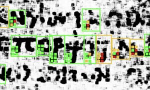
Facebook is fighting the good fight to provide Internet access to people with few financial resources and, by doing this, improve their lives significantly (connecting with others on the Social Media platform is one way of doing that, of course). For this purpose, the Connectivity Lab from the Internet.org initiative employed computer vision technologies and artificial intelligence to map out the whereabouts of the 10% of the world’s population without internet access.
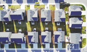
Using satellite images, they covered homes from 20 countries, gathering about 350TB of data. Once this stage was completed, researchers started separating structures built by people from other architectural forms with the same image recognition software that Facebook uses to identify people in group portraits on Social Media. These were used as proxies to get a general idea about the homes of citizens. By cross-referencing this with census data, they redistributed the population number evenly across locations.
The findings will be made public later this year along with the teams’ conclusions. The final objective is to figure out whether Wi-Fi hotspots or cellular technologies are better to implement in this areas.
Follow TechTheLead on Google News to get the news first.