Back in May, the Kilauea volcano in Hawaii went into overdrive, with its residents watching as lava erupted from cracks in the ground and rolled across the island, burning everything in its path.
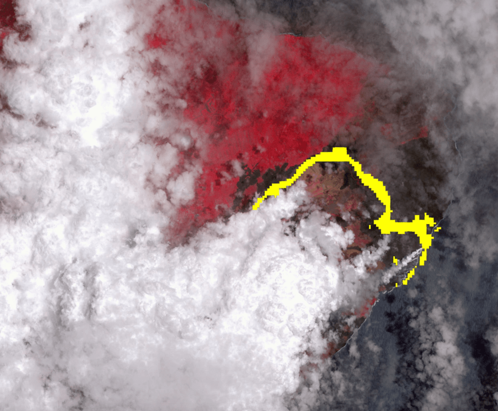
The front seat to that path of destruction was taken by NASA, who released a satellite image which was taken on July 25. In the image, we can see the extent of the damage the hot lava flow caused and how much ground it actually covered, all the way down into the Pacific Ocean.
The lava is pictured in yellow in the image and it can bee seen snaking down to the east of the island. The vegetation around the lava is shown in red, while the clouds above the island in white.
The image was taken with the Advanced Spaceborne Thermal Emission and Reflection (ASTER) radiometer that is on board the Terra satellite. It is able to capture images across 14 spectral bands from both visible and infrared wavelengths. The lava flow was detected by the infrared channels, hence their yellow color.
The Terra satellite has been witness to a large number of natural disasters, having captured the 2017 California wildfires from its orbit around the Earth.
Related: ✍ Mesmerizing Timelapse Shows Hawaii’s Kilauea Volcano Eruption✍
Follow TechTheLead on Google News to get the news first.